Search
Close this search box.

Project

Double T Project

The King – Double T Property is located north of the Iskut River in northwest BC’s Golden Triangle approximately 20 kilometers north of the past producing Snip Gold Mine. The Property consists of an irregular shaped claim block (comprising 1,559.56 hectares) located in the rugged headwaters of the Verrett River and adjoins Enduro Metals Newmont Lake Project (TSX:V-ENDR).

According to the BC Geological Survey, Mihalynuk, 2011, the area north of the Iskut River represents an underexplored but prospective segment of the Golden Triangle that may have been overlooked by exploration companies. Historic assessment reports confirm that previous exploration work by various operators identified significant gold, polymetallic and porphyry copper type occurrences including the NW Zone gold prospect (located 7 kilometres northeast of the Property) and the recently reported Burgundy Ridge porphyry copper- gold prospect (located approximately 10 km north of the Property) both of which are owned by Enduro Metals.

Figure 1: Golden Triangle Map showing location of North Zone and King Vein

Figure 2: Property Map of the King Double T property.

Previous rock sampling and shallow drilling completed on the current Tana Property by Ticker Tape Resources (1987-1990) resulted in the discovery of a high grade, vein type gold occurrence referred to as the King Vein and a skarn style, polymetallic prospect referred to as the North Zone. Follow up prospecting and soil sampling to the south and west of the King Vein and the North Zone in 1990 identified a sheeted vein prospect referred to asthe Mist Zone and several polymetallic soil geochemical anomalies which warrant further evaluation.

In a press release dated July 6, 2020 Enduro Metals (TSX-V: ENDR), reported that the NW Zone is one of multiple gold targets associated with a north east trending, 20 kilometer long fault structure known as the McLymont Fault According to Enduro an on-going technical review of the NW Zone showed that there are several styles of gold mineralization associated with the McLymont Fault and that previous Operators did not assay all of the mineralization that was encountered in previous drill programs. Additional core assays reported by Enduro show that historic drill hole R-08-07, drilled vertically in the NW Zone near the McLymont Fault intersected 144.00m of 3.18 g/t Au and 3.66 g/t Ag starting at 9.51m. Enduro further reported that drilling at the NW Zone has yet to penetrate below 256 metres and mineralization remains open both laterally and at depth. Results of Enduro’s technical studies also highlighted the prospective nature of other targets along the McLymont Fault.

Reader Caution: Tana’s QP has not verified the information reported by Enduro Metals on the adjacent property and it is important to note that mineralization found on adjacent and/or geologically similar properties is not necessarily indicative of mineralization found on the King – Double T Property.

Although published BC Government geological maps do not show that the northeast trending McLymont Fault extends through the Property the results of a detailed airborne geophysical survey completed on the King – Double T Property in 2018 show a northeast trending linear magnetic low located in close proximity to the King Vein and the North Zone, which could potentially represent a southwest extension of the McLymont Fault(?).

Figure 3: Geological Map of the King Double T property.

During 2021, Tana Resources optioned the King Double T Property and contracted SJ Geophysics to compile all of the available airborne geophysical data sets related to the NW Zone and assess the possibility that the McLymont Fault extends across the Property. Tana also funded the costs of petrographic work and the costs of analyzing 20 rock samples that were collected from the King Vein and North Zone in 2020.

SJ Geophysics confirmed that the northeast trending magnetic low that is located immediately south of the King Vein and North Zone may be a south west extension of the McLymont Fault (refer to Figure 3 and 5). The sample assaying and petrographic work completed by Tana during 2021 confirmed historic reports that the rock types present at the King Zone and North Zone are similar to the rock types at the NW Zone.

Figure 4: Airborne Magnetic Field Lines across King Double T claims (SJ Geophysics, Polutnik, 2021).
Figure 5: SJ Geophysics, R. Polutnik, 2021 RTP magnetics with Magnetic Lineaments. Blue (solid) major ctructures, blue (dashed) shows BC Faults. (Polutnik, 2021).

In Tana’s qualified person’s opinion, the character of the Double T Property is sufficient to merit a follow up work program:

In order to continue the evaluation of the Property, the work program should include a compilation of all historical data into a proper GIS digital database for further interpretation. Additional tracing of known mineralized horizons with selective detailed geochemical sampling should then be conducted, along with identification of intersections between mineralized horizons and any shear or fault structures. Plus, detailed geochemistry and mapping with hand surface trenching other areas of interest. 

Propery Description and Location

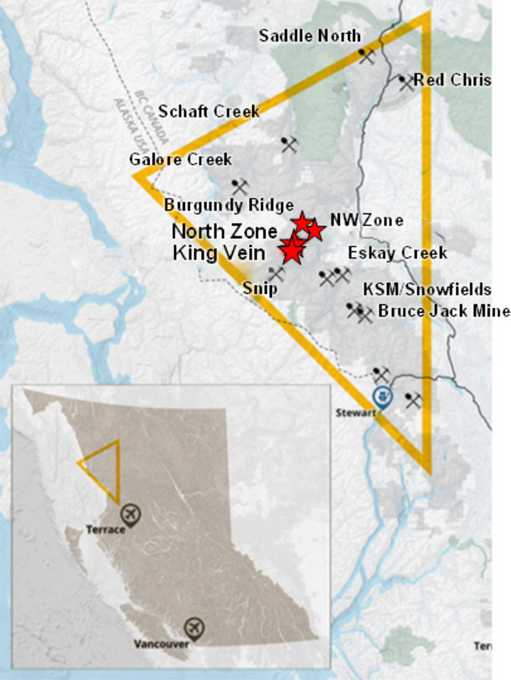
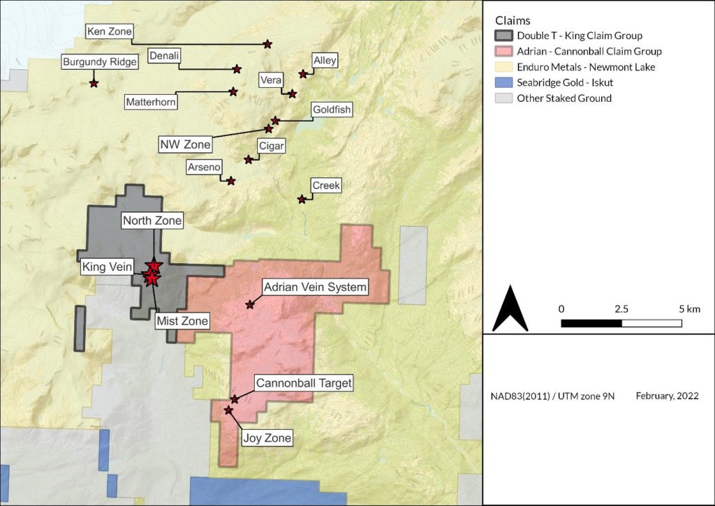
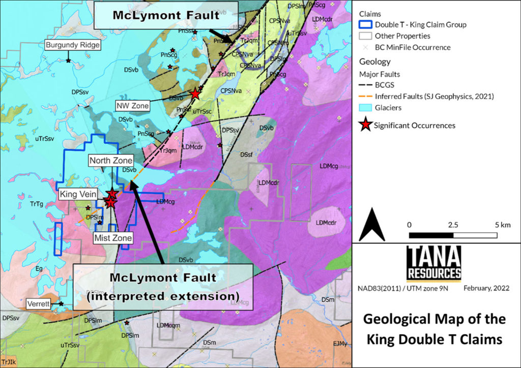
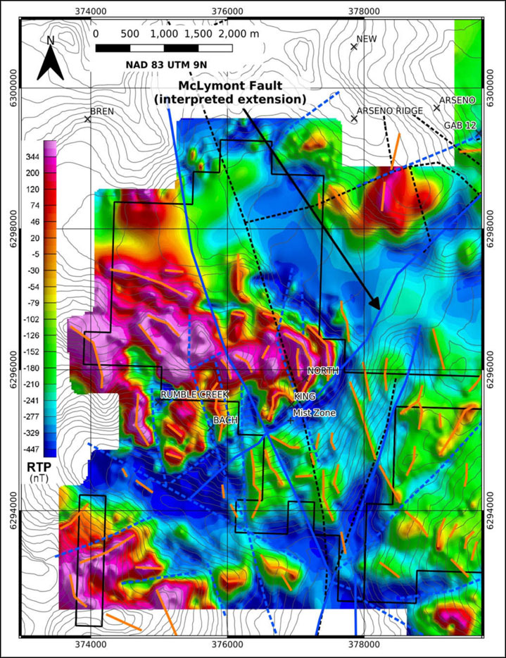
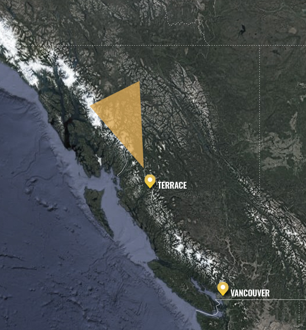
The King – Double T Property consists of sixteen non surveyed, mostly contiguous mineral claims totaling 1,559.56 hectares located on NTS maps 104B14/15 centered at 56.78° North Latitude – 131.00° West Longitude. The claims are located within the Liard Mining District Division of British Columbia. The mineral claims are shown in Figures 2 and 6, and the claim details are listed in Table 2 below.

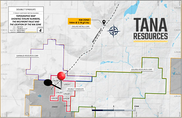
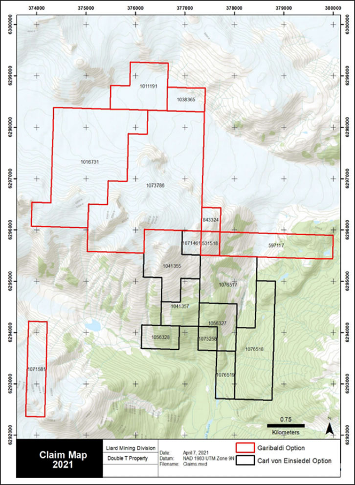
The property can be acquired under two separate options. Under the Carl von Einsiedel Option, Tana Resources Corp. can acquire up to 70% of the Double T Property in an agreement dated January 11, 2021. Under the Garibaldi Resources Corp Mineral Property Agreement dated October 29, 2021, Tana Resources Corp. can acquire 50% of Garibaldi Resources King Property by spending an aggregate on mineral exploration expenditures over 3 years and issuing 900,000 shares to Garibaldi.

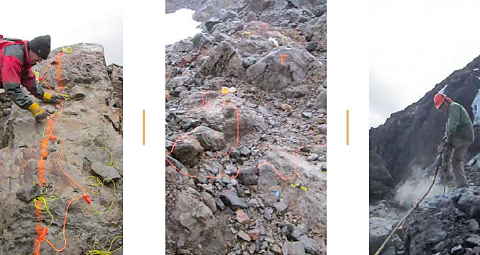
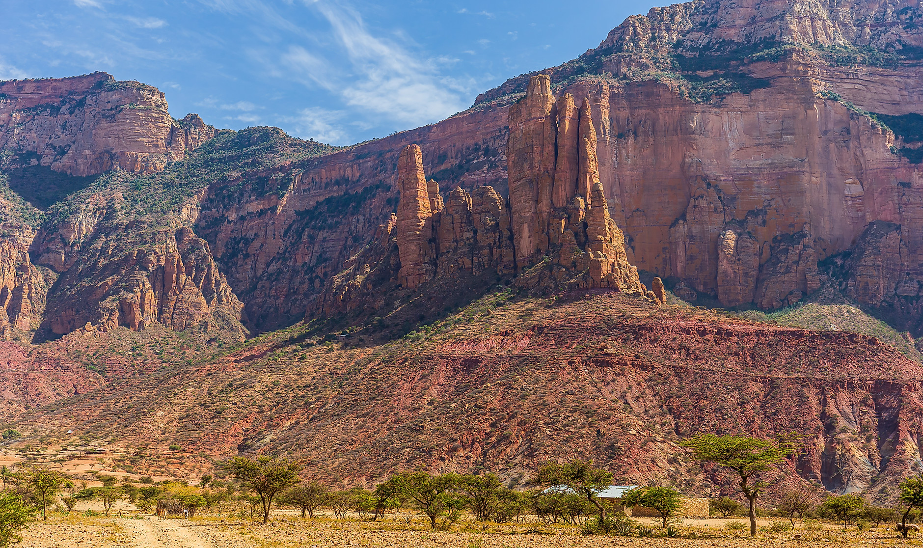
The Property consists of steep, rugged terrain that is partially covered by remnant glaciers in the headwaters of the Verrett River approximately fifteen kilometres north of the Iskut River. The only way to access the claims is by helicopter from either the McLymont Creek power station located approximately 20 kilometers southeast of the Property or from Bob Quin, a government maintained airstrip along Highway 37 approximately 45 kilometres east of the Property. The most cost effective way to complete follow up work on the property will be to make regular flights from either Bob Quin or the McLymont Creek power station and utilize an existing storage building located on the Double T claims.

Figure 5: SJ Geophysics, R. Polutnik, 2021 RTP magnetics with Magnetic Lineaments. Blue (solid) major ctructures, blue (dashed) shows BC Faults. (Polutnik, 2021).

Table 2: Property Claim Information

Claim No. Good to date Area (ha) Owner
1041357 30/09/2023 53.19 Carl von Einsiedel
1071461 30/09/2023 17.72  Carl von Einsiedel
1073258 30/09/2023 17.73 Carl von Einsiedel
1076517 30/09/2023 124.09 Carl von Einsiedel
1076519 30/09/2023 35.47 Carl von Einsiedel
1056327 30/09/2023 53.19 Carl von Einsiedel
1056328 30/09/2023 35.46 Carl von Einsiedel
1041355 30/09/2023 106.35 Carl von Einsiedel
531518 02/10/2026 17.72 Garibaldi Resources Corp
597117 02/10/2026  106.35 Garibaldi Resources Corp
843324 02/10/2026 17.72 Garibaldi Resources Corp
1011191 02/10/2026 88.56 Garibaldi Resources Corp
1016731 02/10/2026 336.64 Garibaldi Resources Corp
1038365 02/10/2026 35.43 Garibaldi Resources Corp
1071581 30/09/2023 70.94 Garibaldi Resources Corp
1073786 30/09/2023 442.99 Garibaldi Resources Corp

Double T Property Regional Geology

The discovery of the Snip and Eskay Creek deposits during the 1980’s triggered a staking rush and in the years following these discoveries exploration companies identified widespread precious metal and porphyry copper occurrences which began to define the boundaries of this prolific mining district. Many of the gold and porphyry copper – gold prospects that were discovered showed significant potential but declining metal prices during the 1990’s made it difficult to raise financing for follow up drilling and the Golden Triangle remained largely dormant until the mid 2000’s.

Since 2005 infrastructure has steadily improved and several of the known porphyry copper gold prospects including Red Chris, Galore Creek (Teck Corp. and Nova Gold), and the KSM Project (Seabridge Resources) have either made production decisions or reported positive feasibility studies. The recent production decision for the high grade Brucejack Gold Deposit (Pretium) combined with the commencement of production at Red Chris and a resurgence of exploration activity have re-established the Golden Triangle as one of BC’s most important mining districts. During construction of a series of run of river power plants along the Iskut River (2013 – 2016) and Altagas extended road access to within 15 kilometers of the Double T Property.

Regional Mineralization

  • According to Mihalynuk, 2011, the area north of the Iskut River, referred to as the McLymont District, represents an underexplored but potentially prospective segment of the Golden Triangle that may have been overlooked by exploration companies. BC Ministry of Mines assessment records confirm that historic exploration work in the McLymont District by various previous operators has identified several significant gold, polymetallic and porphyry copper type mineralized zones.
  • These prospects include the NW Zone gold prospect located approximately 5 kilometers north east of the Double T Property which is currently controlled by Enduro Metals and Romios Gold Resources in the northern part of the McLymont District.
  • In July 2020 Enduro Metals published a new exploration model for the NW Zone and reported that gold mineralization associated with the NW Zone is much more extensive than previously recognized. In a press release dated July 6, 2020 Enduro, announced that the NW Zone is associated with a north east trending fault structure known as the McLymont Fault. According to Enduro an on-going comprehensive technical review of the project recently identified three gold mineralization styles associated with the 20 km long McLymont Fault, one of multiple target areas within the Newmont Lake Project.

Property Airborne Survey

During 2018 and 2019 the current owners of the Double T Property participated in an airborne magnetic and radiometric survey and a follow up interpretation with the owners of two adjoining properties located to the east and southeast. The airborne survey was carried out on September 15, 2018.

Based on the results of the 2018 airborne survey the current owners have recommended that all available airborne geophysical data and all historic technical data for the Double T Property (including published drill results, rock and soil sample results) be compiled into a GIS database and compared with the results published by Enduro Metals. The total cost of this review is estimated at $40,000. Costs incurred by the current owners between 2018 and 2020 are approximately $42,000.